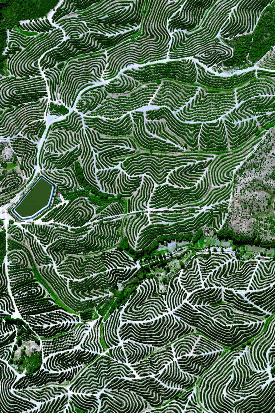
#12 Fruit Orchards, Huelva, Spain
37.714546°, -6.532834°. Fruit trees swirl on the hills of Huelva, Spain. The climate here is ideal for this growth with an average temperature of 17.8° C (64° F) and a relative humidity between 60% and 80%.
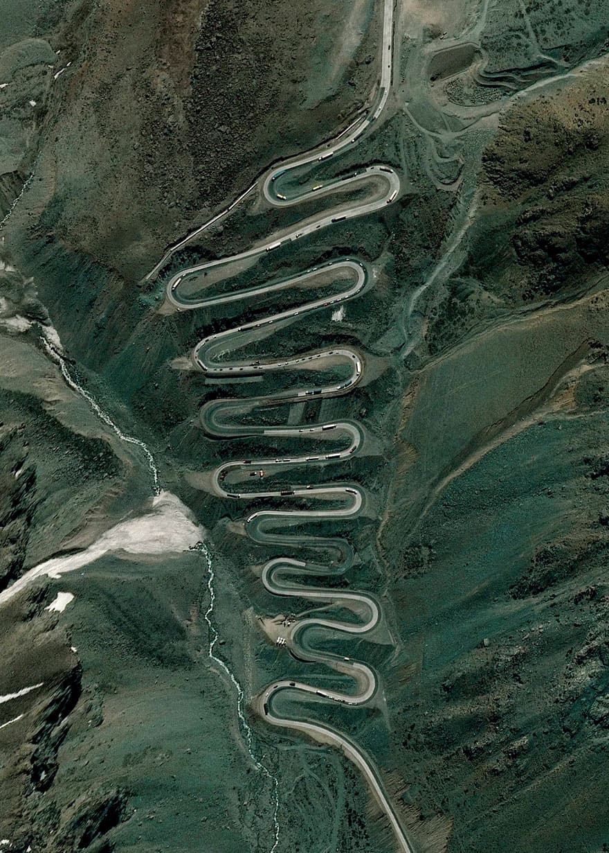
#13 Los Caracoles Pass, Andes Mountains
32°51’6″S 70°8’16″W. Los Caracoles Pass, or The Snails Pass, is a twisting mountain road located in a remote section of the Andes Mountains on the Chilean side of the border with Argentina. The path climbs to an elevation of 10,419 feet, has no roadside safety barriers, and is frequented by large trucks.
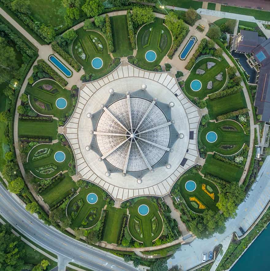
#14 Bahá’í House Of Worship, Wilmette, Illinois
42°4′27″N 87°41′3″W The Baha’i House of Worship in Wilmette, Illinois, is the oldest surviving Baha’i House of Worship in the world and the only one in the United States. The building contains an auditorium that seats 1,191 people beneath a 138 foot-high (42 m) domed structure. You’ll also notice that many components of the complex come in sets of nine as the number symbolizes perfection and completion in the Baha’i faith.
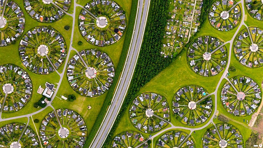
#15 Brøndby Haveby, Brønby Municipality, Denmark
55 ° 38 ’12.836031 “N, 12 ° 23′ 58.386726″ E
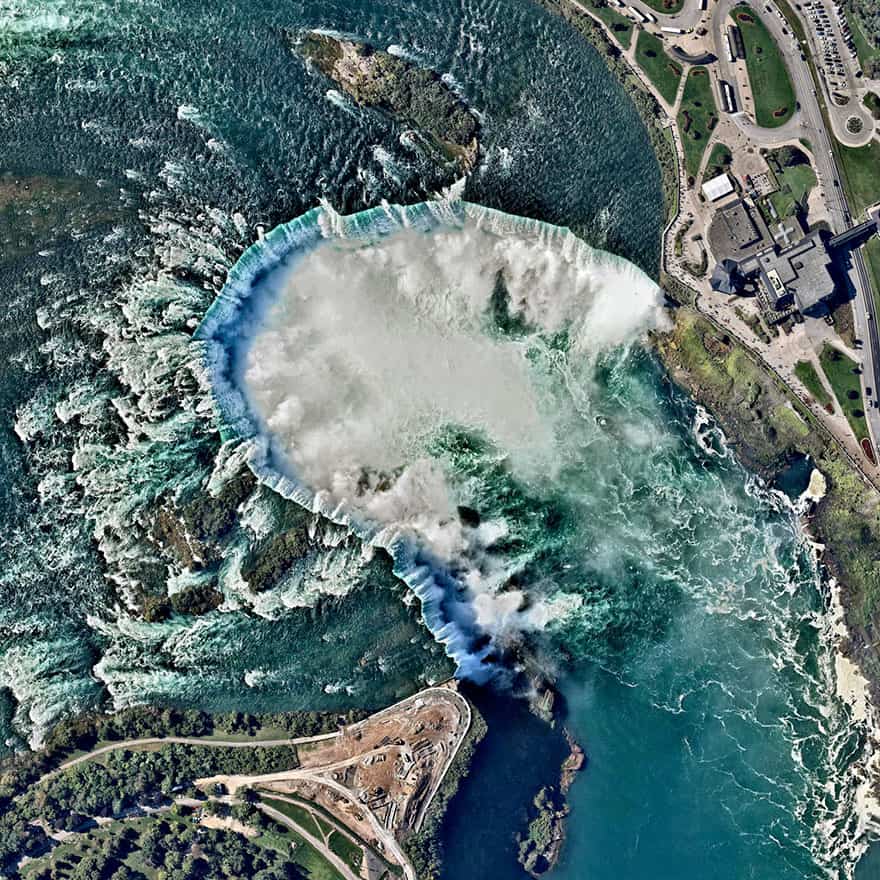
#16 Niagara Falls, Canada, United States
43.077305°N 79.07562°W. Niagara Falls is the collective name for three waterfalls that straddle the border between Ontario, Canada and the United States. Horseshoe Falls is seen here. The falls have the highest flow rate of any waterfall in the world, with a vertical drop of more than 165 feet (50 m). The Maid of the Mist, also visible here, is a boat that has carried passengers into the rapids below the falls since 1846.
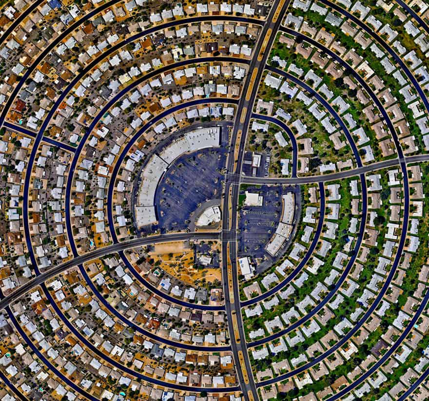
#17 Sun City, Arizona, USA
33.6189504, -112.291099. Houses, built in concentric circles, make up a section of Sun City, Arizona, USA. When the development opened on January 1, 1960, the event attracted a crowd of more than 100,000 onlookers and the “futuristic development” was featured on the cover of Time magazine.
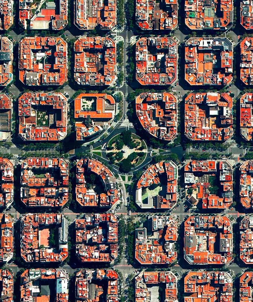
#18 Plaça De Tetuan, Eixample District, Barcelona, Spain
41.394921°N 2.175507°E. Plaça de Tetuan is a major square located in the Eixample district of Barcelona, Spain. The area characterized by its strict grid pattern, octagonal intersections, and apartments with communal courtyards.
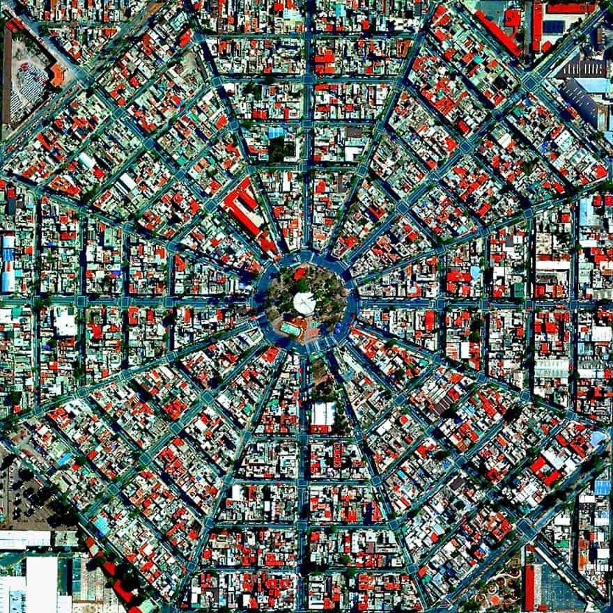
#19 Plaza Del Ejecutivo, Mexico City, Mexico
19.420511533°, -99.08808712°. This week we will be looking at fascinating examples of urban planning – a major focus of the Where We Design chapter in our new book “Overview”. To start off, here is one of our favorite shots of the radiating streets that surround the Plaza Del Ejecutivo in Mexico City, Mexico. If you have examples of other cities that you think might look particularly mesmerizing from above, please let us know in the comments on Facebook.
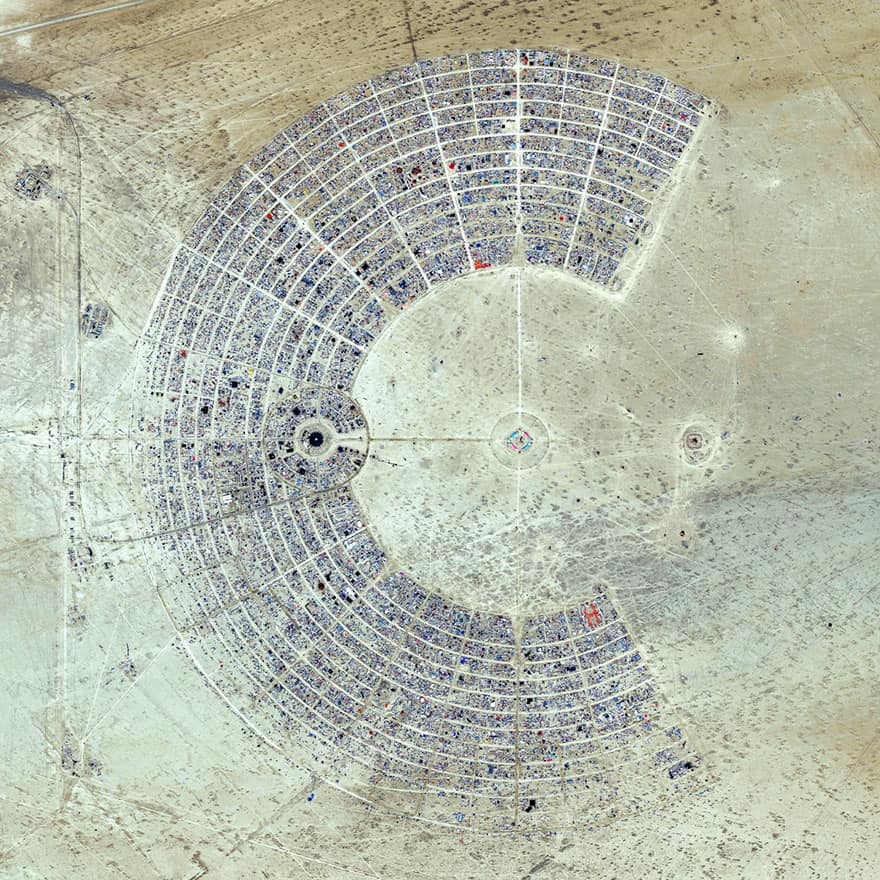
#20 Burning Man, Black Rock City, Nevada, USA
40°47′13″N 119°12′16″W. Over the next few days, thousands of people from around the world will head to the desert in Nevada, USA to construct Black Rock City. Laid out in a grid plan with radiating avenues named after the numbers on a clock, the city serves as home to roughly 60,000 people for Burning Man, an annual week-long event. Burning Man is described as an experiment in community, art, self-expression, and radical self-reliance. Additionally residents in Black Rock City practice one of the event’s key principles of ‘Leave No Trace’ – meaning significant efforts are taken to make sure as the city is disassembled in the days following the festival, the desert returns to its original state.