How people see the world is largely subjective, which is one of the reasons photographer Benjamin Grant is inspired to change the way people view the planet. Every day, the talented artist shares one satellite photo from Digital Globes to inspire humans around the world to see Earth in a unique and new way. He told Bored Panda:
“With a focal length 16 times longer than a standard DSLR camera, the cameras are so powerful that you can take a picture of a beach ball on the Golden Gate Bridge in full resolution…from Los Angeles. I try to present the images with no bias and let people decide what these altered landscapes mean, based on the facts and the visual evidence in the frame. I believe that this perspective is a means to start a conversation about the condition of our planet and how we can better protect it.”
“I create the images by stitching together numerous high-resolution satellite photographs. I partnered with a satellite company called DigitalGlobe and accordingly have access to their full archive of imagery. Once I have put together a composite image, I then treat it like a photograph to make it as crisp and easy to understand as possible to accentuate certain patterns, colors, or places,” he adds.
If you’d like to see more incredible satellite images, be sure to check out the book Grant put together which includes over 200 high-resolution photographs. Titled “Overview: A New Perspective of Earth”, it can be purchased through Amazon. All excerpts are courtesy Greta J. who submitted the series to Bored Panda.
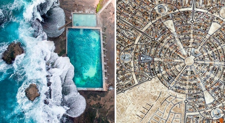
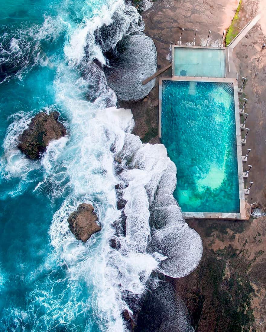
#1 Beach Pool, Mona Vale, NSW, Australia
-33.6787655, 151.3160979. This shot is of an the ocean pool at Mona Vale Beach, located in the suburbs of Sydney, Australia.
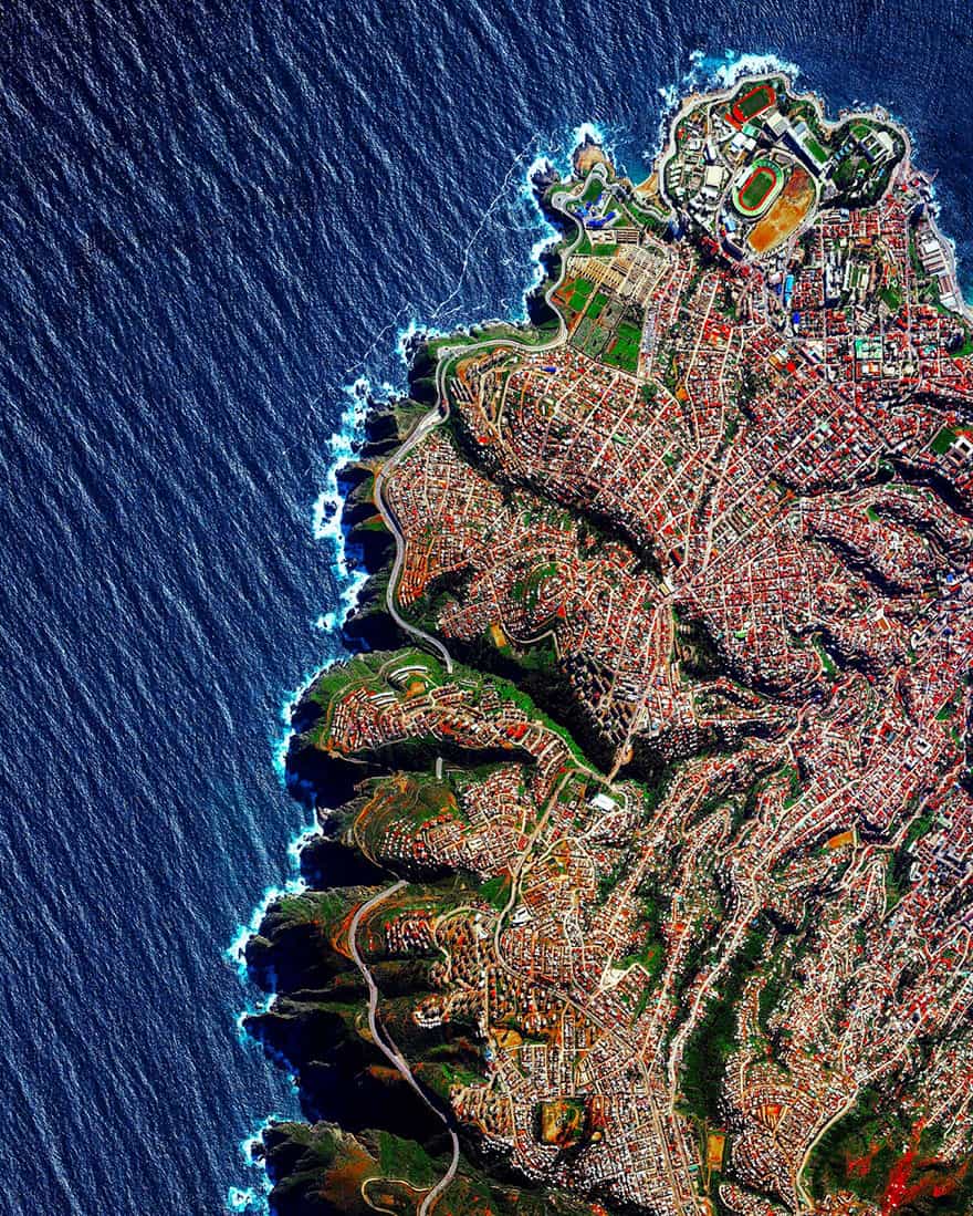
#2 Valparaíso, Chile
Valparaíso, Chile is built upon dozens of steep hillsides overlooking the Pacific Ocean. Known as “The Jewel of the Pacific,” the city is the sixth largest in the county and is home to approximately 285,000 residents.
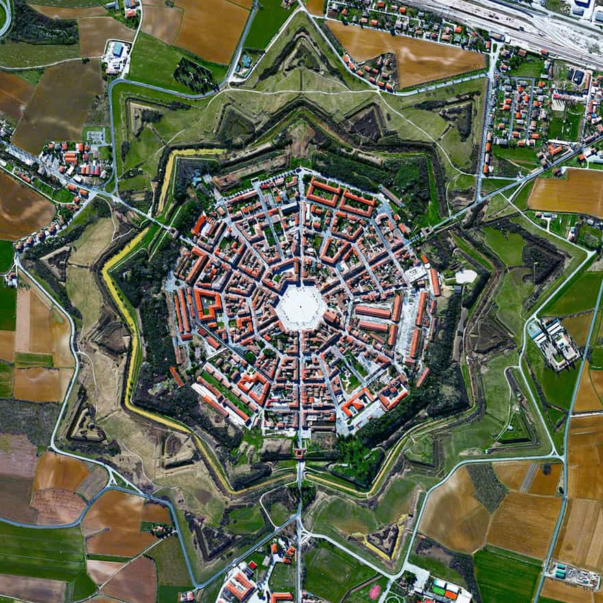
#3 Palmanova, Italy
45.904892400°, 13.317671100°. The town of Palmanova, Italy is recognized by its concentric layout known as a star fort. The rationale for this construction was that an attack on any individual wall could be defended from the two adjacent star points by shooting the enemy from behind. The three rings that surround Palmanova were completed in 1593, 1690, and 1813.
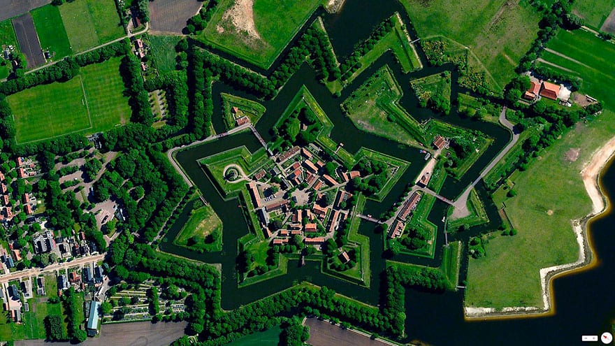
#4 Bourtange, Vlagtwedde, Netherlands
53.0066°N 7.1920°E. Bourtange is a village with a population of 430 in the municipality of Vlagtwedde in the Netherlands. The star fort was built in 1593 during the Eighty Years’ War when William I of Orange wanted to control the only road between Germany and the city of Groningen. Bourtange was restored to its mid-18th-century state in 1960 and is currently used as an open-air museum.
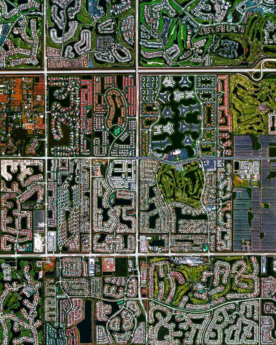
#5 Boca Raton, Florida
26.386332°, – 80.179917°. Residential development is seen in Boca Raton, Florida, USA. Because many cities in the state contain master-planned communities, often built on top of waterways in the latter half of the twentieth century, there are a number of intricate designs that are visible from the Overview perspective. Boca Raton is home to roughly 91,000 residents.
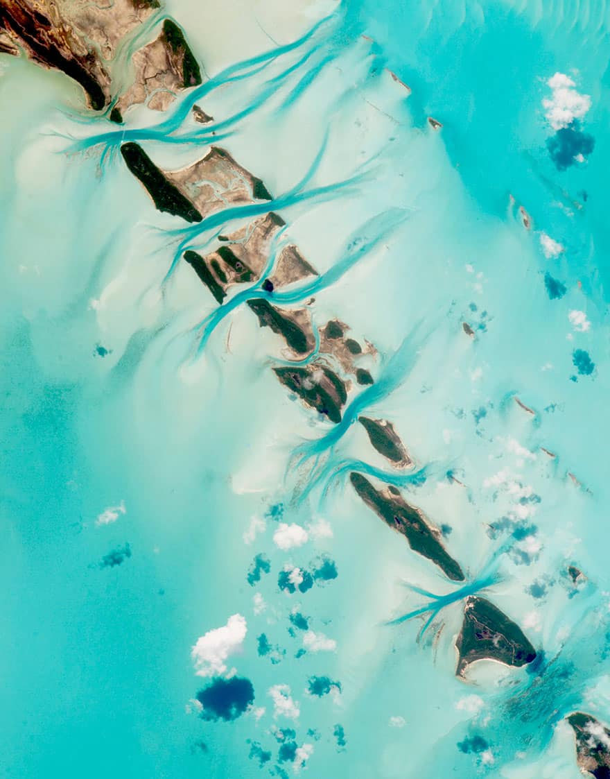
#6 Bahamas
Stunning blue waters surround and pass through the tidal channels of islands in the Bahamas. Small tidal changes on the banks cause water to flow through the narrow channels between the islands, first in one direction and then the other. The darker blue sections of water are the deepest parts of the channels and the surrounding light blue color is more shallow (less than 25 meters / 80 feet). This photo was captured from the International Space Station and is courtesy of NASA:
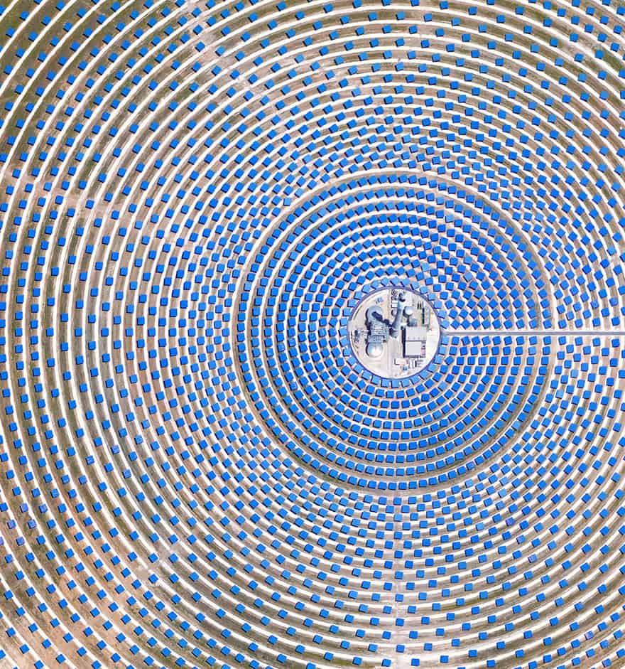
#7 Seville, Spain
This solar concentrator in Seville, Spain use 2,650 heliostat mirrors to collect and focus the sun’s thermal energy to heat molten salt flowing through a 460-foot tall central tower. The molten salt then circulates from the tower to a storage tank where it is used to produce steam and generate electricity. In total, the facility displaces approximately 30,000 tons of CO2 emissions every year.
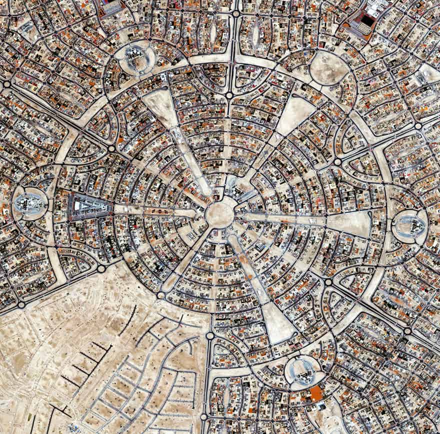
#8 Al Falah Housing Project, Abu Dhabi, United Arab Emirates
24.445187, 54.719998. The Al Falah Housing Project is located in Abu Dhabi, United Arab Emirates. The development covers 12.5 million square meters with 4,857 villas as well as mosques, schools, a shopping mall, and a hospital.
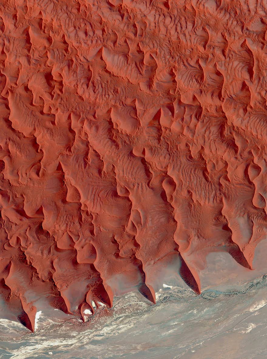
#9 Salt And Clay Pan, Namib Desert, Namibia
Salt and clay pan located on the edge of the Namib Desert in Namibia. These reddish sand dunes of the desert, seen in the top half of this Overview, are among the tallest in the world, with many rising more than 656 feet (200 meters).
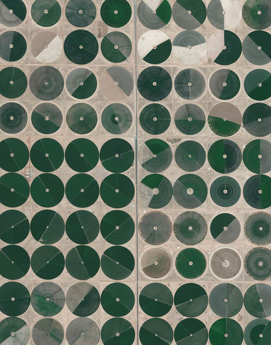
#10 Pivot Irrigation Fields, Wadi As-Sirhan Basin, Saudi Arabia
30.089890096°, 38.271806556°. Center pivot irrigation is used throughout the Wadi As-Sirhan Basin of Saudi Arabia. Water is mined from depths as great as one kilometer (~3,000 ft), pumped to the surface, and evenly distributed by sprinklers that rotate 360 degrees. Spurred by a government effort to strengthen its agriculture sector, cultivated land in Saudi Arabia grew from 400,000 acres in 1976 to more than 8 million acres by 1993. For a sense of scale, the total area shown in this Overview is approximately forty square miles (32,000 acres).
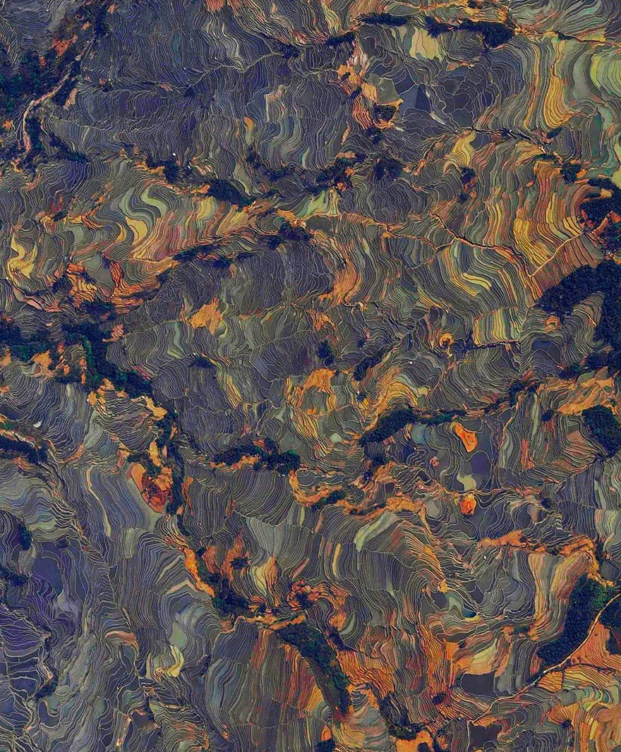
#11 Rice Terraces, Yuanyang County, China
23°09′32″N 102°44′41″E. Rice paddies, constructed in steps, cover the mountainsides of Yuanyang County, China. Cultivated by the Hani people for the last 1300 years, the slope of the terraces varies from 15 to 75 degrees with some having as many as 3,000 steps. As we’ve been getting a lot of questions recently about prints, I want to mention that this Overview, and many others, can be purchased directly from our website in the Printshop section!